geophysical
Imaging
Partners
OUR SeRVICES
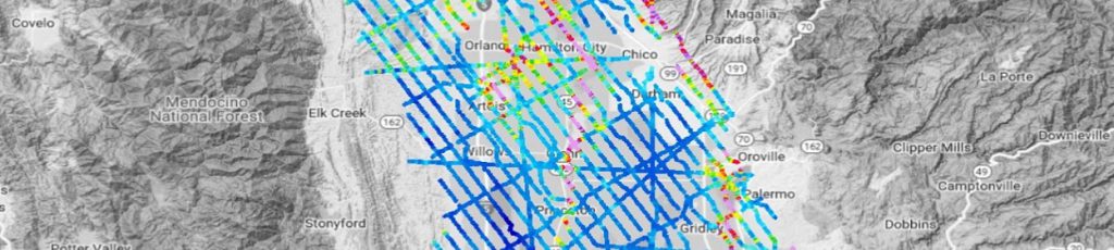
Detailed 3D images of the subsurface
Our Geophysical solutions provide detailed 3D images of the subsurface. We use state-of-the-art high resolution techniques to help our customers ensure that the best possible data are collected at any time.We help you on planning your projects, conducting surveys and interpretating geophysical results.
Data as an active asset
Dissemination of the geophysical results is a very essential task. We constantly push on developing novel approaches on how data can be presented. We make data an active asset by providing the data in formats that can be utilized easily by our customers (e.g., in Google Earth format etc.).
We prioritize to be involved in research and development activities as we acknowledge that learning is a never ending process and we enjoy to share what we have learned to support the overall development of geophysical solutions.
Robust workflows
We understand that time is essential to many of the clients. We typically deliver preliminary results during the field operation and we make use of robust workflows to secure high-quality processing of the data and a fast data turn around.
Accurate identification of targets
Our Geophysical solutions provide detailed 3D subsurface images that enable accurate identification of targets e.g., most suited areas for surface water infiltration. The real 3D geophysical imaging makes a significant change compared to traditional surveying approaches.
We use state-of-the-art high resolution techniques to help our customers ensure that the best possible data are collected at any time.
From planning projects to interpretating results
We help you on planning your projects, conducting surveys and interpreting geophysical results.
APPLICATIONS
In general, our services fall withing the following main applications:
- Hydrogeology
- Geotechnical
- Polluted Sites
- Mineral Exploration
Methods
When conducting a geophysical project, it is crucial to not only record high-quality and reliable data but also to select appropriate methods.
The right choice of method depends on a number of
parameters including
- Desired depth of investigation
- Geology/hydrogeology and the physical parameter contrasts
- Desired resolution
- Size of the survey area
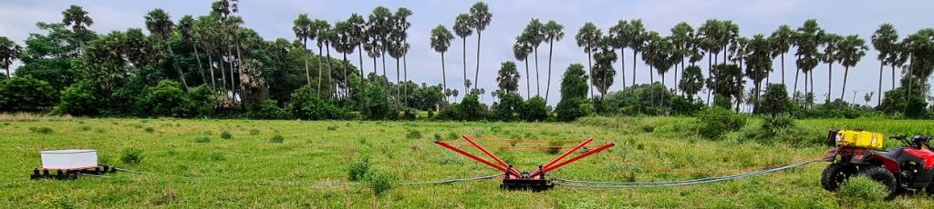
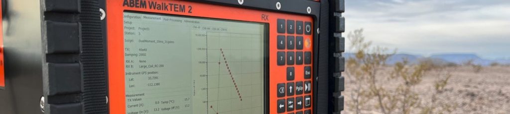
Some of the more common and modern techniques are:
- AEM
- tTEM
- Drone Mag
- Passive Seismic
ABOUT
Providing geophysical services most efficiently
Geophysical Imaging Partners was founded by two experienced geophysicist with a goal to provide geophysical services most efficiently.
Our team has strong competencies within the geophysical methods specially Electromagnetics, Electrical Resistivity, Induced Polarization and Nuclear Magnetic Resonance. We have extensive experience in hardware and software development, fieldwork, project management and integration of geophysical and (hydro)geologic data.
Our vision is to be an attractive “partner” by taking part in any geophysical project or handling the entire project.

Contact us
Ahmad-Ali Behroozmand
ahmad@geophysicalimaging.com
Phone & WhatsApp:
+1 415-430-7173
Pleasant Hill, CA 94523, USA
Max Halkjaer
max@geophysicalimaging.com
Phone & WhatsApp:
+45 5386 7600
8600 Silkeborg, Denmark
Follow us on Linkedin: